
UNIT 1: PHYSICAL GEOGRAPHY
Basics: Geographic Tech (1/2)
What Is Aerial Photography and How Does It Work?
Aerial
photography is - as it sounds - the process of taking photographs from
the air, but there is more to it than simply using a light aircraft or
helicopter and flying up to take photographs. There are many elements to
an aerial survey that must be considered to ensure that the data is
useful enough to extrapolate whatever is being investigated. It is often
difficult to see elements of the landscape on the ground, features can
easily be missed, and what might seem like an insignificant bump from
ground level can become more significant in a wider context ; some
landscape types are difficult to access on foot so aerial photographs
are vital to study and map them.
They have been used as a method
of landscape studies for over a century, especially in archaeology and
researchers have learnt much about the world around us; its applications
today are broad and coupled with the growing technology of GIS
(geographic information systems), the potential means that the method
will not become obsolete any time soon. Aerial photographs are taken in
two basic forms and both have different uses and applications: oblique
and vertical. Even today in an age of high quality digital imaging,
black and white images are preferred - partly because they are cheaper
but also partly because the contrast of black, white and greys makes it
easier to pick out features.
Look at the image below, of a
greenway in Boston, USA. See which features you can make out. Think
about which other features this image would not prove useful for.
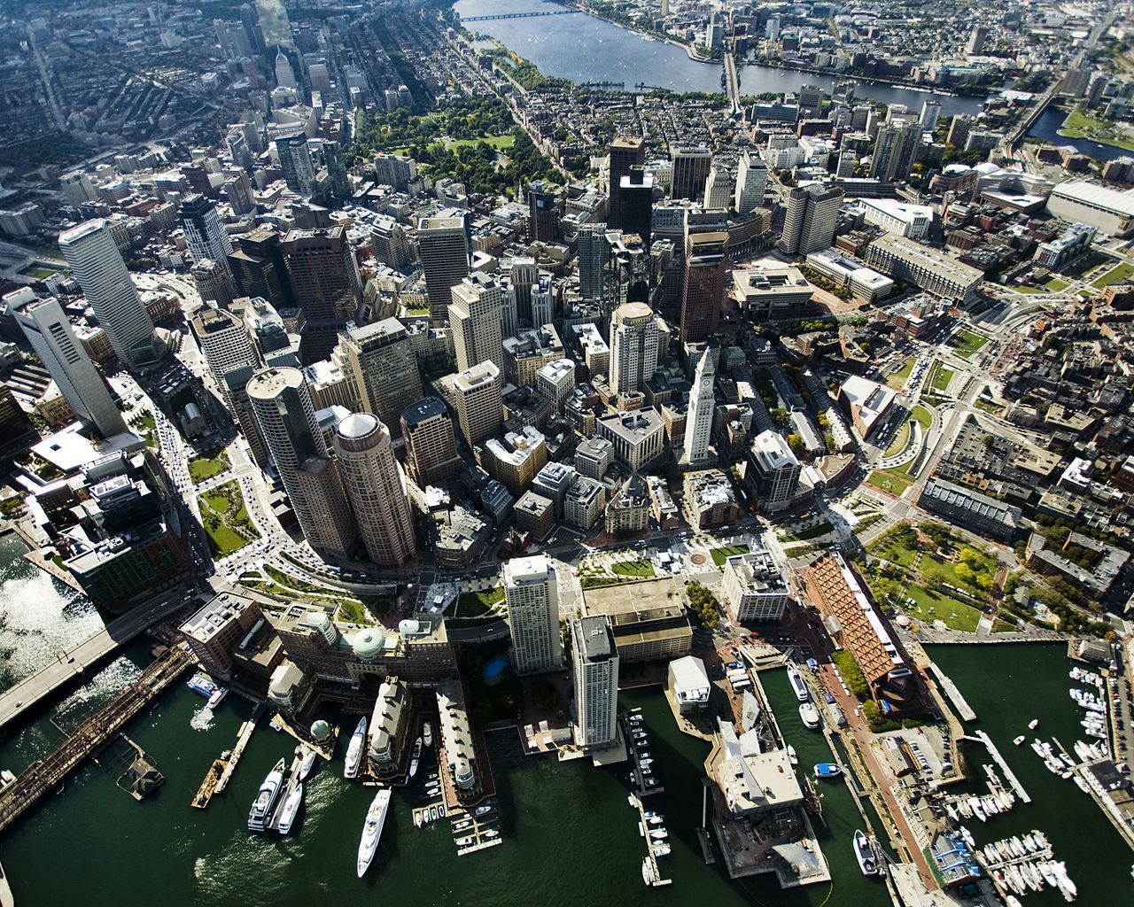
Oblique
These images, such as the one above, are usually
taken at an angle, typically 45 degrees but as they are often taken
manually, they can be whatever angle gives the best view of the feature
or landscape. The oblique image is primarily used in archaeology to take
a wider context of a feature and the area around it, and also to give
depth. Nearly always taken at a much lower elevation than the vertical
image and in few numbers, its application is fairly limited and often
taken for a specific purpose. There is a problem in perspective because
the farther away a feature is, the smaller it will appear: nearer
objects of comparable size appear larger than those that are farther
away so it is often best to take a selection or to use a frame of
reference on the ground for perspective purposes. These images are taken
from small fixed-wing aircraft and helicopters and are perfectly suited
for monitoring erosion of features and monuments throughout the year
and over the course of many decades.
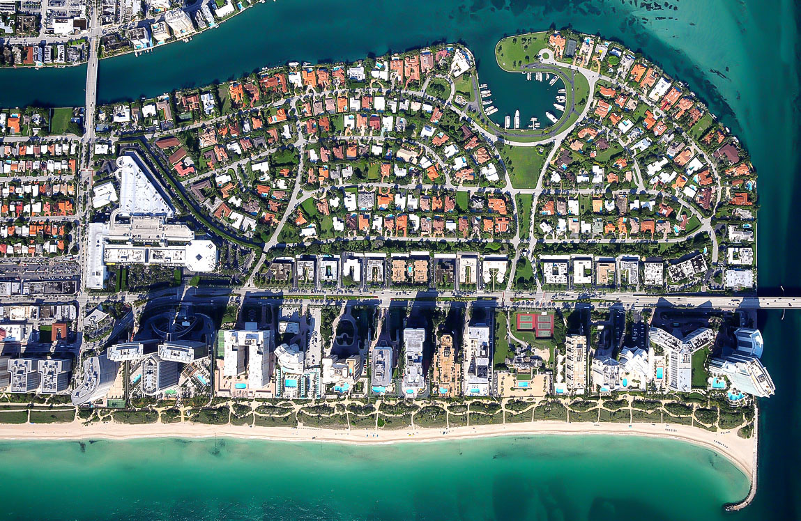
Taking a photograph straight down over a landscape is the more familiar
form of aerial photograph. It is a plan view so there is no perspective
to distort the image. This also means that it is difficult to read the
lay of the land such as changes in height - though there is a work
around to create 3D image through stereoscopic views, using a device to
examine two at once. This usually gives a good impression of the
variation in the elevation of land . They are taken at regular heights
for consistency so it is easier to compare contexts of a landscape taken
on the same day, or many years apart to examine development. Rarely
used in archaeological applications except perhaps sometimes to find
interesting earthworks and other sites that are easily missed on the
ground, they cover a much wider area and focus on topography rather than
specific details.